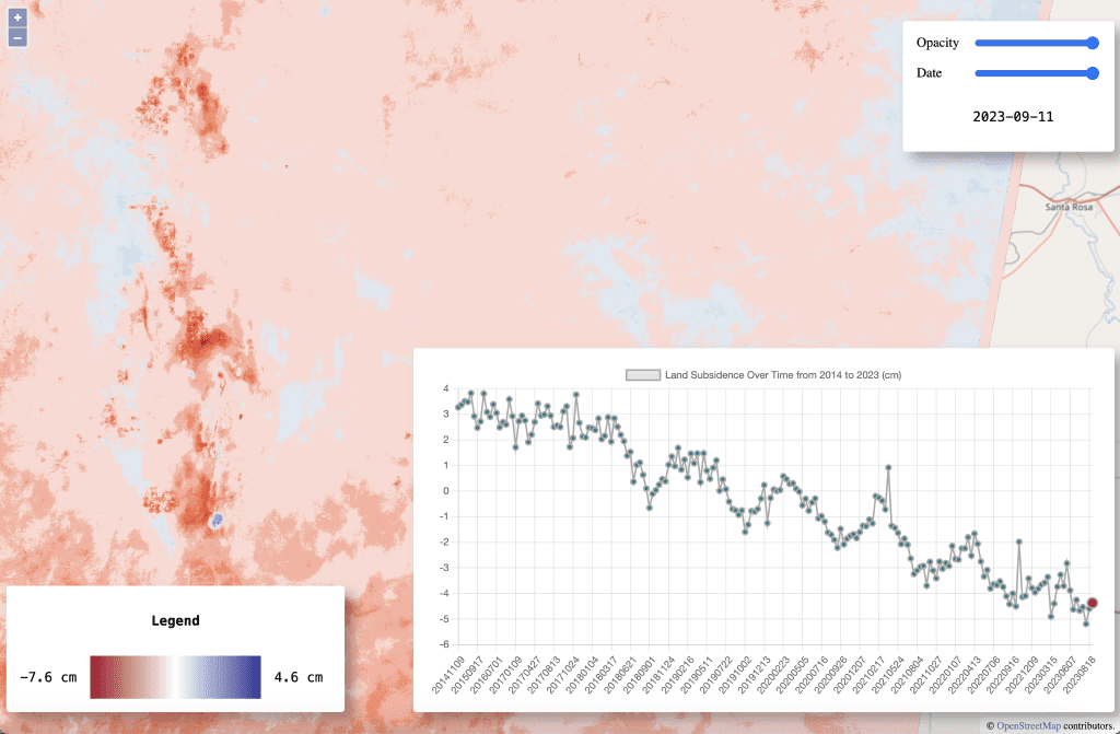
By Carly Salazar, Computer Science Major, Statistics, Mentor Eric Lindsey. Water is limited in the Southwest, making water conservation essential. The Estancia Basin, an agricultural region in central New Mexico, relies on groundwater extraction for irrigation. Over the past 70 years, groundwater levels have decreased by more than 80 feet and continue to decline. The over-extraction of water can lead to severe environmental effects, including land subsidence, soil compaction, and the depletion of the water table. This can negatively impact agriculture, which heavily relies on water and soil in the area. Despite these impacts, many people are unaware of the problem and its effects.
Using InSAR (Interferometric Synthetic Aperture Radar), we can gather satellite data to detect changes in the Estancia Basin ground’s surface elevation, which can be used to identify land subsidence. However, this dataset is large, not easily accessible, and requires significant processing power to analyze. My project addresses this by developing a dynamic website to explore the land subsidence data in the Estancia Basin. Users can interact with a map by clicking on specific areas to view land subsidence at those coordinates and track changes over time. This data can be useful to farmers and resource managers in the area to help manage groundwater use by indicating where water may be over-extracted.